
Calabazas Creek Regional Park and Open Space Preserve
Frequently Asked Questions
-
The park is located at the end of Nuns Canyon Road along the western slope of the Mayacamas Mountain range – about seven miles north of the town of Sonoma and 2.5 miles northeast of Glen Ellen.

-
Just under 1,290 acres.
-
The park is currently open to the general public on a limited basis
The public access events occur once or twice a month through programmed park preview days and docent led outings conducted at the park.
Click on the link for information about that schedule: Calendar of events and park preview days for Calabazas Creek Regional Park & Open Space Preserve
Although the park is currently open on a limited basis, there are nearby Regional and State Parks that offer similar experiences that you can enjoy anytime right now. These include:
Sonoma Valley Regional Park
Hood Mountain Regional Park and Open Space Preserve
Sugarloaf Ridge State Park
Jack London State Historic Park -
During park preview days, there is vehicle parking available in the Park Entrance Area, otherwise known as “The Quarry” at 1199 Nuns Canyon Road, Glen Ellen, CA
The Park Entrance Area is located approximately one-half mile east of Highway 12, just past Nelligan Road. There is no access to the park from Nelligan Road.
Most of the park property (Upper Preserve) is separated from the Park Entrance Area by approx. ½ mile. Park visitors must park their vehicles in the Park Entrance Area and walk/ride to the Upper Preserve. The current connection between the two locations is along Nuns Canyon Road. The master planning process will explore options for how to better link the Park Entrance Area to the Upper Preserve with a multi-use trail.

-
The park is located near the eastern border of the traditional territory of the Coast Miwok, with the Wappo tribal territory to the east and Southern Pomo tribal territory to the north.
Sonoma County Regional Parks recognizes that the park is on or near the ancestral lands of the Coast Miwok, Wappo and Southern Pomo who are the original caretakers of this area, and respectfully acknowledge the Indigenous peoples who have been stewarding and maintaining relationships on this land as knowledge keepers for millennia.
In the late 1800s, Anglo-Americans and European settlers introduced ranching, dairy operations, dry farming, and mining to the region. In 1837 the 18,833-acre Rancho Los Guilicos (that included today’s park) was granted by Gov. Juan Bautista Alvarado to John Wilson and his wife, Ramona Carrillo, sister-in-law of General Mariano Guadalupe Vallejo.
In the mid-1850s the area was homesteaded by Hugh and Sarah Nunn. In 1889, the homestead was purchased by Mary Ellen Pleasant, a former slave turned civil rights leader and San Francisco entrepreneur. The property became known as Beltane Ranch.
After Mary Ellen Pleasant passed away in 1904, the Beltane Ranch changed owners several times. In 1936, Ralph and Effia Heins purchased the property. Operating a turkey farm on the lower property and running cattle on the upper ranch, the Heins also invited many people to visit the ranch as guests. The Boy Scouts used a campsite in Nunns’ Canyon and fisherman were granted access to trout fishing on Calabazas Creek. Others were invited to hike, ride horses and enjoy the property.
From the 1950s to the 1970s, a section of the lower property was leased and operated as the Nunns’ Canyon Quarry.
In the 1960s, Rosemary Wood, Effia Hein’s niece returned to the property, opened a Bed & Breakfast, and continued to run the ranch and host public events for local historical societies and recreation groups.
In 2004, the Sonoma County Agricultural Preservation and Open Space District (District) acquired the Park for the residents of Sonoma County from Beltane Inc. (descendants of the Heins/Wood family) under the “Recreation” category in the District’s Acquisition Plan 2000. The acquisition was to protect the wildlife habitat on the Park as well as offer public recreation.
This acquisition reflects generations of stewardship and vision as public land. The Wood/Benward/Krause family continues a 120 year history of agricultural hospitality on the adjacent Beltane Ranch property.
More about the Park’s history is contained in these reports:
A Homestead Era History of Nunns’ Canyon and Calabazas Creek Preserve c.1850 – 1910
-
In July 2021, the District transferred title of the property to Regional Parks and conveyed with that transfer a Conservation Easement and Recreation Covenant on the property.
The Conservation Easement and Recreation Covenant guide the use of the property to balance resource protection and management with passive public recreation. To preserve the natural resources and open space qualities of the property, the Conservation Easement designates specific use areas for development in support of public recreation and education activities. The deed and easement include a building envelope in the historic quarry site, which is located within the Park Entrance Area “The Quarry”, as well as one floating camping envelope identified for backcountry camping, which would be specifically located during the development of the master plan, and additional spike-camps and/or program-related camps, subject to District approval.

-
Over the next two years, Regional Parks will prepare a master plan that will address public access to the park and provide more detail about implementing resource management goals outlined in the Calabazas Creek Open Space Preserve Management Plan prepared by Ag + Open Space in 2016.
The master planning process includes a number of public outreach opportunities to provide input and comment on proposals as they are developed.
-
The Nuns Fire in October 2017 started near the park and significantly impacted the property. The fire damaged the vegetation in a patchwork throughout the property, with damage varying by species and location. Extensive work at the park is ongoing, including felling hazard trees, processing dead and down material as needed and access allows, and improving emergency vehicle access. The impacts of the fire are still quite visible.
In September 2020, the Glass Fire came within close proximity to the park. Fire crews cut contingency fire lines within the park to aid in containment, but the fire did not reach the park property.
-
Vegetation has been strategically thinned for fire hazard reduction. The work is ongoing, particularly due to continuing tree mortality from the 2017 Nuns Fire.
Road and trail stabilization to reduce erosion and sedimentation in the watershed is scheduled to be completed in the near future.
-
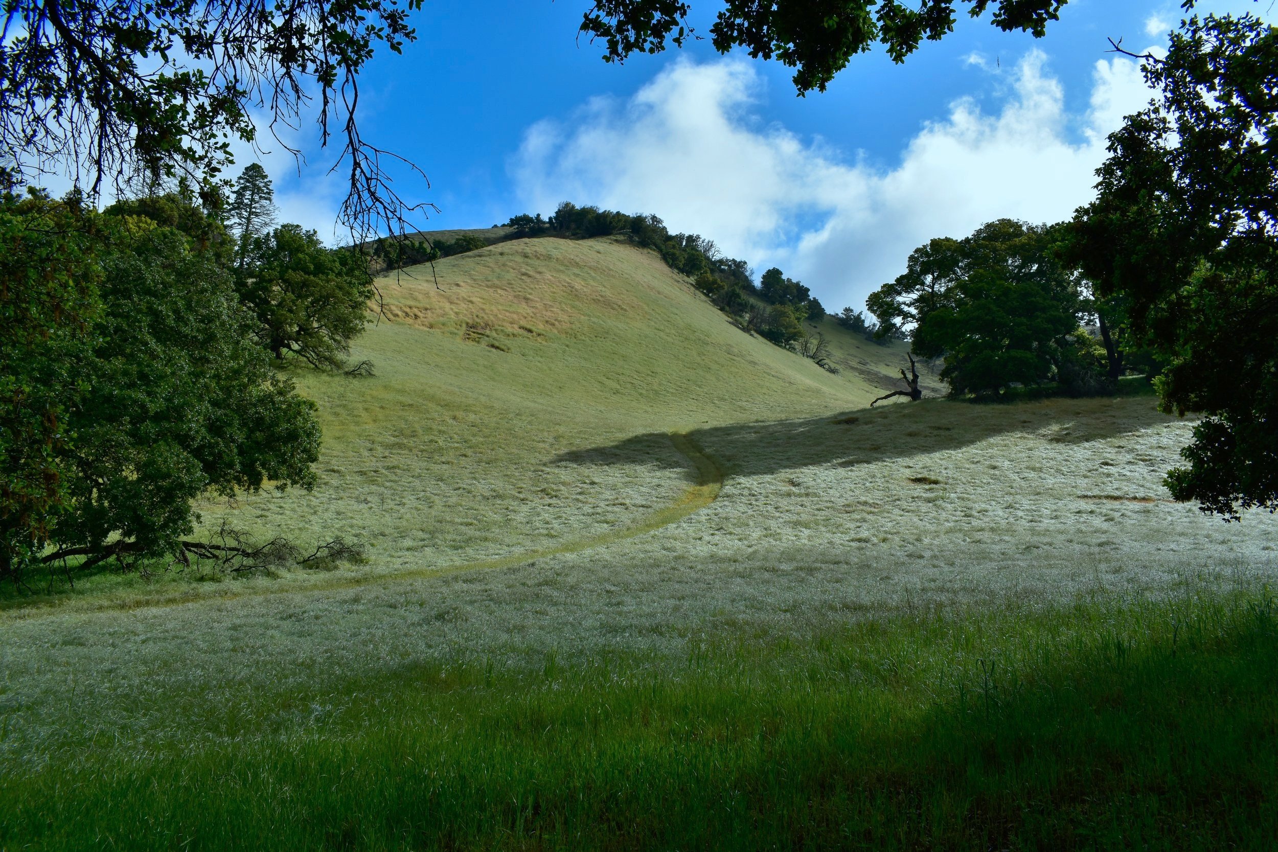
While the park forms part of the Valley of the Moon scenic viewshed, it really is a hidden wonder to be explored in person.
This picturesque park includes the headwaters of Calabazas Creek, a redwood canyon, open grasslands, and areas of oak woodlands and chaparral. This canvas of habitat types can be seen along the main ridgeline of the Mayacamas Mountains that separate Sonoma and Napa Counties. Panoramic views are available from the upper elevations and ridgelines of the park. From the Upper Preserve entrance to the top of the ridgeline, it is an approximate 8-mile round trip, with an elevation change of almost 2,000 feet.
The Park Entrance Area “the Quarry” is located in a historic quarry. The quarry was in operation for about twenty years. The quarry mined hard rock in an open pit operation to obtain the rock product - a type of hardened volcanic ash rock called welded rhyolytic tuff. The white, shiny rock is very hard and contains layers or deposits that have become cemented or welded together by high temperature. As a result of mining, the quarry has steep wall faces about 12 to 15 feet high on the west and north side, below Nelligan Road, with a more gradual slope on the east side, and a broad low berm along Nuns Canyon Road. This perimeter berm contains buried rock and concrete debris from the mining operation, covered by topsoil. The bottom of the quarry is flat to gently sloping and also covered by a thin layer of soil or rock. The few scattered trees that occur within the quarry appear to be volunteer coast live oak.
As a flat, disturbed area with few trees or native vegetation, this landscape provides easily accessible areas suitable for park programs and facilities, and vehicle parking.
-
The park emphasis will be for low intensity outdoor recreation and education activities that are generally related to non-motorized and nature-based trail uses. The Conservation Easement and Recreation Covenant held by Ag + Open Space specifically states that the park will be “available to the public for low-intensity public outdoor recreation and educational uses in a manner consistent with the Conservation Easement and the provisions herein” and goes on to state that those provisions “shall include, at a minimum, general availability of the property for public hiking, picnicking, and nature study”.
It is anticipated that public access facilities will include a new trail connection parallel to Nuns Canyon Road from the Park Entrance Area to the Upper Preserve, as well as improvements to the existing road and trail system to reduce erosion and sedimentation, improve accessibility and protect sensitive habitat.
Decisions about exactly the type of trail use other than hiking, whether dogs will be allowed in the park, and additional public access facilities will be determined through the master planning process.
-
The Conservation Easement and Recreation Covenant held by the Ag + Open Space District (District) allows for camping within the building envelope in the historic quarry site, which is located within the Park Entrance Area “The Quarry”, and one floating camping envelope identified for backcountry camping, which would be specifically located during the development of the master plan. Additional spike-camps and/or program-related camps, which are defined as minimum impact, temporary locations, are subject to District approval.
The deed and easement include a building envelope, located in the historic quarry site (Park Entrance Area “The Quarry”),
Campfires will NOT be allowed in the park.
There will be overnight staff supervision in the Park Entrance Area.
-
Yes, Regional Parks intends to continue park programs at the park within the spirit of the Conservation Easement after the park officially opens to the public. The Conservation Easement allows for unlimited programs for up to 50 people at the park and allows for other larger programs and activities based on the size and character of the event. The Conservation Easement allows up to 6 recreational or educational events of up to 250 people per year. Public recreational and educational special events, regardless of size, shall take place within the building envelope, which is located within the Park Entrance Area “The Quarry” or on designated trails.
-
The Park Entrance Area “The Quarry” will provide parking for park users. Like other Sonoma County Regional Parks, there will be a day-use fee for parking and those visitors holding active Regional parks passes will not be required to pay that fee. Parking will NOT be allowed along Nuns Canyon Road or Nelligan Road.
The Conservation Easement directs public recreational and educational special events, regardless of size, to take place within the building envelope, which is located within the Park Entrance Area “The Quarry”, except as such events may make use of designated trails. Trail use may only occur during daylight hours. Amplified sound associated with permitted special events may occur during daylight hours in the building envelope. The topography of “The Quarry” helps provide a sound barrier and visual barrier to neighboring properties.
Campfires will NOT be allowed in the park.
There will be overnight staff supervision in the Park Entrance Area “The Quarry.”